GPS linked with mapping is now well established and exemplified by products such as Garmin's Oregon, Montana and GPSMAP64 series devices. These are well known products that are accepted to be pretty reliable although there are some known limitations of the software.

To me, the major limitation is the restricted options for mapping and often high prices for high quality topographic maps. Several third parties, for example talkytoaster, provide packed versions of OpenStreetMap open source maps which does broaden the options for affordable mapping.
 |
| Sample from Look n feel by TT |
ViewRanger runs via a web browser on PCs and this component provides a great resource for designing routes and looking for interesting features on a map - you can use any free maps or tiles that you have purchased. More importantly the system runs as an App on Android, iOS and Symbian platforms thus covering the vast majority of smartphones. It is worth stressing that both the desktop and mobile programmes are free, you only pay for licensed mapping.
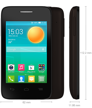
After a little online searching I found a new Alcatel Pop D1 for sale on eBay for £32 including delivery. This is a dual core Android 4.4 device with a basic specification (512MB RAM, 4GB flash) including 12 channel GPS. The 'obsolete' smartphone market is very fluid so any given day other devices will be available.
The unit is clearly made to a budget with a plastic body and screen, all of which flex under pressure. The battery is removable which is helpful and the standard Sim and microSD easy to fit. I used a 8GB microsSD to make sure that I'd plenty of space.
The phone was readily charged and set-up with ViewRanger. I deleted as many of the bundled games as possible but some of the apps are built-in and can't be deleted. They can be deactivated though. With a bit of tidying the key icons can be fitted onto a single screen so there's no need to swipe, or more importantly, the option of swiping and hiding ViewRanger! I made a new Google account and haven't linked it to my mail/blog/calendar/paypal accounts so that I don't need to set any security. From previously using my Nexus tablet out of doors I knew that having to type in passcode was irritating whilst walking. Of course now I'm at risk of losing some credit from my SIM if the phone is stolen but again that is a new account and a SIM isn't required for GPS.
The phone boots-up in 45seconds with ViewRanger starting in 12 seconds until a map is displayed and centred to the previous known position. GPS acquisition is varied as is the case for all devices but 30s seems sufficient in most cases.
In early tests I found that the GPS was powering down as the phone went to sleep which is great for battery life but not for navigation. I tried various settings in ViewRanger to keep the GPS switched on but none seemed to work. After a bit of online searching I found that this was a known problem. There are various Apps on GooglePlay that aims to force the GPS to keep running and I found that ActiveGPS seems to work best for this combination of hardware and app.
No comments:
Post a Comment